Phone: (406) 777-5271
Email: jenelle@townofstevensville.com
Address: 206 Buck Street
Stevensville MT 59870
Hours of Operation: M - F 8a.m. to 5 p.m.
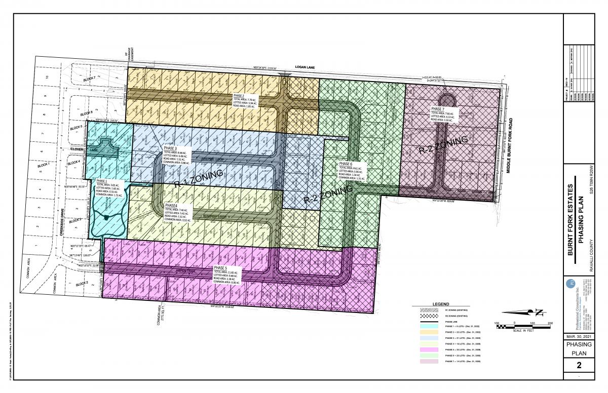
Burnt Fork Estates is a planned residential and commercial addition to the Town of Stevensville. The property lies northwest of the intersection of Middle Burnt Fork Road and Logan Lane, abutting the first phase Of Creekside Meadows. Our proposal for the 57.68-acre tract is to create 78 single-family lots adjacent to Creekside Meadows and 43 multi-family lots further to the south. Then for the 8 acres adjacent to Middle Burnt Fork Road we are proposing to re-zone the property to allow 16 light commercial lots.
For many years the land has been a grazing meadow for cattle. It was flood irrigated from diversions of creeks flowing from the southeast. When Ellison Cattle Company decided to subdivide the land in 2003, this 57.68 acres was included for the final three of the five original phases of the development. Ellison completed the first two phases of Creekside, but did not continue with phases 3, 4 and 5. So the land remains undeveloped, although it has been annexed into the Town of Stevensville and zoned for residential use. Due to the passage of time since the original subdivision approval, the Town has determined that a new preliminary plat application is needed.
The Town’s Annexation, Zoning and Subdivision Approval for Creekside Meadows from 2003 is included under Tab 8.
This land is entirely open grassland, with irrigation water flowing in from the southeast corner of the property. That water is piped across the property, delivering it to the adjacent property to the west. That property was previously part of the larger ranch. The properties to the west along Middle Burnt Fork Road include large residential and grazing land, along with the school bus barn and the Pantry Partners shop. The Stevensville School campus also occupies much of the land to the west, with newly improved soccer fields abutting the west boundary of our subdivision. To the north is the first phase of Creekside Meadows.
When the Town of Stevensville annexed this property, they zoned it for single-family and multi-family use. R-1 single family zoning runs from Phase 1 of Creekside Meadows south to the quarter section line in the middle of the property. The Developers intend to leave this zoning intact, thus protecting the residential pattern of Creekside development and extending it well into Burnt Fork Estates.
R-2 zoning was applied to the remainder of the property running south to Middle Burnt Fork Road. The developers want to leave most of that zoning intact, but we are requesting a change to light commercial zoning for the southerly 10+/- acres adjacent to Middle Burnt Fork Road. The developers believe this change is appropriate, given the pattern of development extending up Middle Burnt Fork Road from Town. Pantry Partners and the school bus storage area are typical of the low intensity commercial use that we anticipate.
The overall layout of Burnt Fork Estates is intended to create a livable and attractive neighborhood, compatible with adjacent residential development, as well as with nearby grazing meadows and the light commercial land uses along Middle Burnt Fork Road. With the Stevensville School campus immediately to the west, we anticipate students from Burnt Fork Estates will enjoy easy access to their school activities.
The proposed road design is the same pattern that was installed in Creekside Meadows. Boulevard sidewalks will add to the appeal of the neighborhood.
Within the subdivision there are three generous parks, or common areas, accessible to all the residents via the proposed boulevard sidewalks. These parks provide an essential function for the residents of Burnt Fork Estates by offering central gathering areas for recreation that are a vital component of the overall recreational needs of the neighborhood’s residents. While the developers recognize that these common areas are designed to meet the needs of the residents of Burnt Fork Estates, these areas also reduce the demand of our residents on the use of other City Parks.
The parkland dedication requirement for residential lots of this size is 11% of the net lotted area. Developers are proposing to plat 34.31 residential acres, so the required parkland is 3.77 acres. The proposed Common Areas total 4.5 acres, which exceeds the requirement. There is no parkland requirement for commercial lots.
It is important to note that the developers, Dwight and Ralph Hooley, were intent on responding to the requests of Creekside Meadows residents. When we met with a committee of their Homeowners Association, they expressed a desire for an open space between Creekside and Burnt Fork Estates. To accommodate that request, we have designated a Common Area of nearly two acres immediately adjacent to the Creekside development.
The Committee also requested that through traffic be limited between Creekside and Burnt Fork Estates. Accordingly, developers have made Clover Lane as a cul-de-sac street, and directed nearly all of our traffic patterns toward our newly proposed access onto Logan Lane.
Ellison Cattle Company has transferred the irrigation water rights to Ralph and Dwight Hooley. It is the Hooleys’ intention to in turn transfer the rights to the Town of Stevensville.
Water rights information is included under Tab 7.
The proposed covenants are intended to establish a livable and attractive neighborhood for future residents. These Covenants will protect and enhance the quality of development in this subdivision, and they will complement the zoning requirements so as to provide for orderly growth in this new neighborhood for Stevensville.
The applicants have met with City officials and Fire Chief Motley regarding the location of a fire station on Lot C12, adjacent to the Middle Burnt Fork/Logan Lane intersection. While the discussions have not finalized this transfer, the Hooleys believe this could become an important asset for the Town of Stevensville and so they have included this as part of the subdivision proposal.